

The National Risk Index is an easy-to-use, interactive tool that shows which communities are most at risk to natural hazards. It includes data about the expected annual losses to individual natural hazards, social vulnerability and community resilience, available at county and Census tract levels.
Access the National Risk Index
Benefits of Using the National Risk Index
The National Risk Index can be used to support resilience building efforts and ensures that resources go where they are needed most. Download and read fact sheets to learn how this resource can be used to support mitigation planning, hazard mitigation assistance and risk communication.
Learn how organizations and communities are using the National Risk Index data to develop plans and projects that reduce natural hazard risks. Refer to FEMA's Best Practices Library.
Getting Started
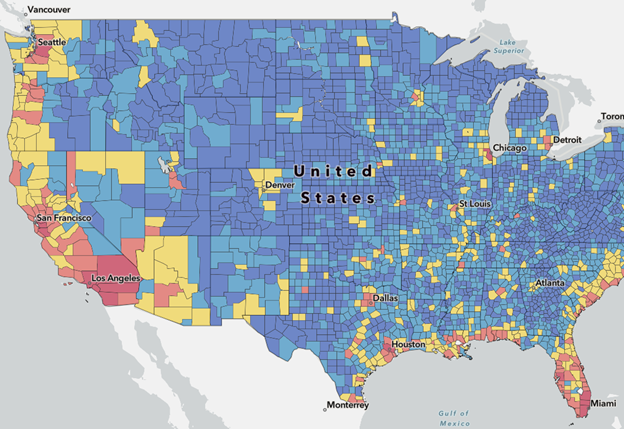
Visit the National Risk Index
- Explore the interactive map.
- Understand your risk to local natural hazards.
- Access the Index's data to create your own maps and apps.
- Visit the Frequently Asked Questions to learn more.
Download Technical Documentation
National Risk Index Technical Documentation
National Risk Index Data Version and Update
FEMA has recently published a series of tutorial videos highlighting the main features of the National Risk Index and explains the methodologies behind our interpretation of risk data. View the list of videos.
Take Action in Your Community
Learn how to take action in your community through:
- Reducing natural hazard risks
- Exploring hazard-specific resources
- Assessing your needs
- Learning how communities reduced their risks
- Engaging with additional resources
Email us with questions or to share how you are using National Risk Index.