Graphic

FEMA.gov est en cours de mise à jour pour se conformer aux décrets du président Trump. Merci pour votre patience et votre compréhension.

This page has not been translated into Français. Visit the Français page for resources in that language.
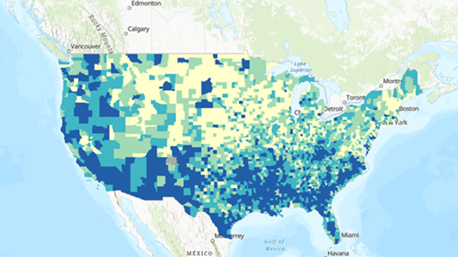
This application visualizes the 2018 overall Social Vulnerability Index (SVI) for U.S. counties. The SVI uses U.S. Census data to determine the social vulnerability of every county and tract, based on 15 social factors, including poverty, lack of vehicle access, and crowded housing.
CDC Social Vulnerability Index