Carson City became Nevada’s second community to participate in FEMA’s High Water Mark Initiative. This initiative helps communities increase local awareness of flood risk by posting high water mark signs to help educate the public and encourage mitigation action.
In Carson City, Eagle Creek presents a significant flood risk. The creek threads its way through the entire city and has a floodplain that is often hundreds of yards wide. The city teamed up with the Carson Water Subconservancy District to find the best spot along this creek to illustrate a high water mark.
An existing hiking and biking path along the creek offered a close view of the creek, but the team decided a simple sign at that location couldn’t convey the impact of the historic flood levels. Instead, they had the idea to transform the concrete floodwall on the opposite side of the creek.
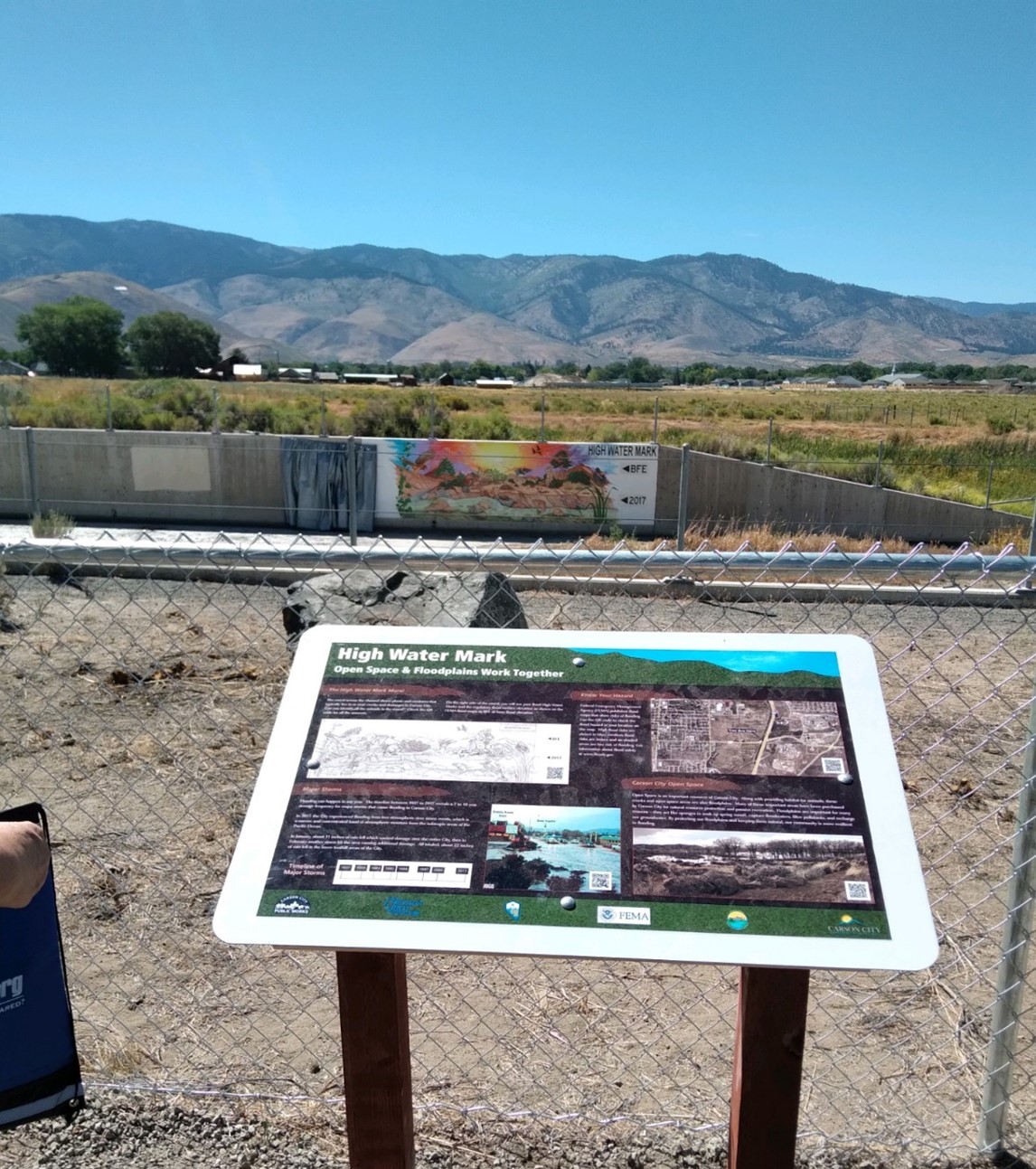
Retired Carson City designer and life-long artist Debra Fong was asked to breathe life into the concept. She transformed a floodwall into a 10-foot by 30-foot concrete canvas depicting a colorful representation of wildlife and vegetation native to the Eagle Creek watershed. The right side of the mural has two black and white reminders of the Base Flood Elevation and the 2017 flood elevation, with room to update future high water mark elevations.

The 10-foot by 30-foot high water mark sign shows wildlife and native vegetation in the Eagle Creek watershed and identifies the current high water mark and the normal base flood elevation.
FEMA Region 9 National Preparedness Branch Chief for Preparedness and Analysis Christine Borgognoni is excited about the project.
“This is the intersection of public safety and art,” she said. “It reflects the collaboration between the Carson Water Subconservancy District, Carson City, the Nevada Division of Water Resources, U.S. Army Corps of Engineers, National Weather Service and FEMA to educate and promote flood awareness, disaster preparedness and community resilience.”
The city is no stranger to notable flood events. This includes the 2005 New Year’s Eve flood, which caused over $2 million in damage. In 2014 monsoonal thunderstorms which dropped 1.5 inches of rain in 20 minutes, causing flash flooding on the east side of the city. Most recently, the 2017 high water mark displayed on the new mural was the result of two atmospheric river storms that each dropped 11 inches of rain.
Carson City Floodplain Manager Robb Fellows hopes this project will help the city prepare for future flooding events.
“This high water mark reminds residents that Nevada floods and stresses the planning and execution of many projects throughout the city to reduce flood impacts,” said Fellows. “Not only do open floodplains protect our communities when disasters occur, by providing flood storage and reducing strain on culverts and ditches, they also add to the quality of our lives in countless ways.”

On the trail side of Eagle Creek, this interpretive sign describes (with corresponding QR codes) river conservation, floodplain wildlife, flooding history, and the highwater mark sign.
Last month, Carson City organized an event around the high water mark as part of a Disaster Preparedness Festival. Attendees were invited to walk along a path to the mural site for a dedication ceremony. Another creative high water mark monument is under development for the Carson River in 2023.
If your community is interested in installing their own sign, visit FEMA’s High Water Mark Initiative to find tools and resources.

