

No matter where you live in the United States, there are natural hazards known and unknown. While some areas have higher risks, no place has zero risk. From ice storms to volcanic activity, from tornadoes to tsunamis, these natural hazards pose a threat to communities and the human environment. It is important to understand what causes these risks and what you can do to reduce them. The National Risk Index is designed as a user-friendly tool to help individuals and communities gain a deeper understanding of their risks.
The Index’s interactive mapping and data-based interface allows you to visually explore individual datasets (at the ZIP code or Census tract level) so that you can better understand the risks at a glance, without needing technical expertise or support.
To use the National Risk Index, follow these steps:
Head over to the National Risk Index website.
The website has everything you need to learn more about your community’s risks, including how the index works and how it tracks 18 natural hazards.
Explore the Map
Once you open the map, you will get a quick view of the counties or Census tracts at risk to natural hazards.
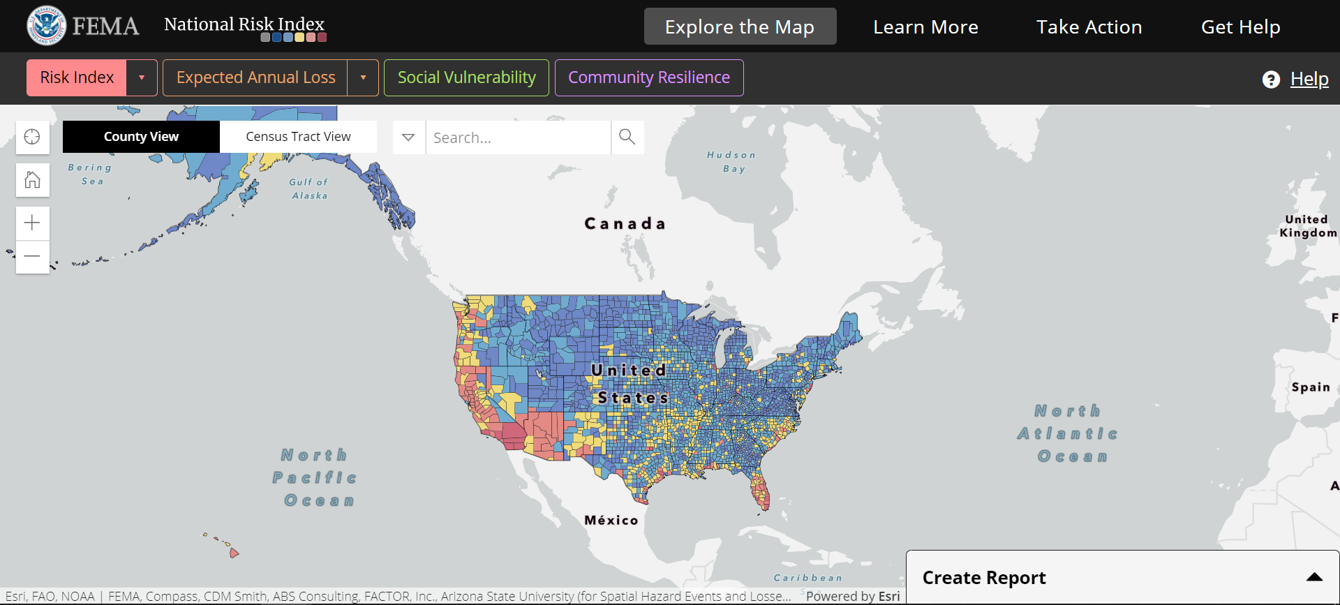
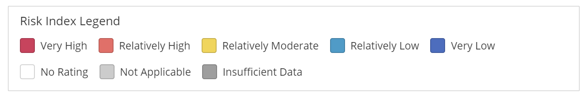
The map is color coded, allowing you to visualize areas of very low to very high risk.
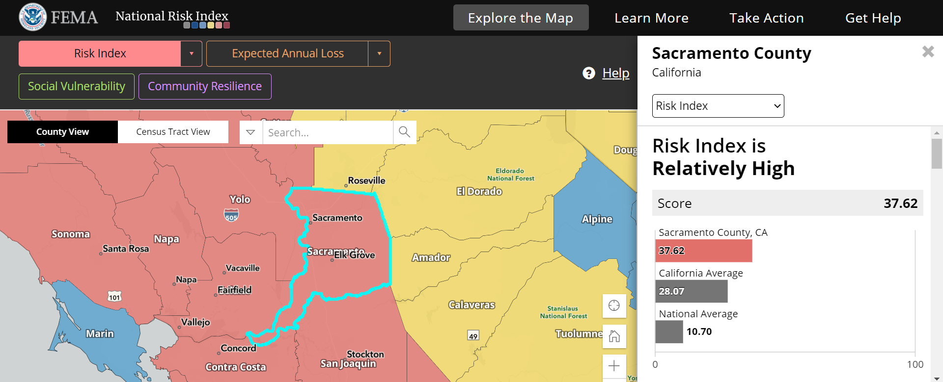
Select your county
To learn more about your risk, click to select your county on the map or use the search feature. You will be able to see a complete breakdown of natural hazard risks in your community, including the expected annual loss, social vulnerability and community resilience scores. The overall risk scores your area receives is based on all these factors. For example, an area with a lower risk score could still be prone to natural hazards, but the community may have implemented effective protective measures, boosting the community resilience score, therefore lowering your risk. You will be able to see a complete breakdown of all the factors involved in determining risk, including population, hazard types, agriculture and building value.
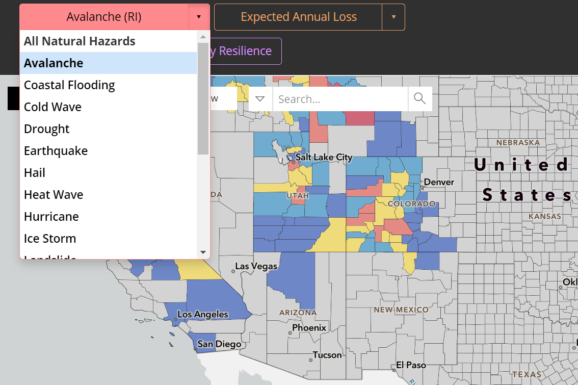
Sort by Natural Hazard
You can also filter the map by selecting specific hazards. For example, after selecting “Avalanche” from the drop-down menu, you can quickly see which parts of the country are at risk from avalanches.
Create a Report
If you need to pull a report on the information, you can simply select the “Create Report” tool in the lower righthand corner of the map. This will allow you to download the data and even compare the statistics among multiple counties or Census tracts.
Read about how you can Reduce Your Natural Hazard Risk
The National Risk Index helps you understand the hazards and risk factors that your community may face. Once you know more about your community’s hazard risks, you can take steps to protect it and help improve a risk score.
These actions can reduce your community’s risk:
- Apply for Grants.
Checking and fulfilling the requirements necessary to obtain funding from any federal or state grant programs for your natural disaster mitigation, preparation, emergency response, and/or recovery efforts. - Plan Mitigation Projects.
Preparing and/or updating your community’s risk assessment and mitigation plan, document progress and plan additional mitigation projects. - Implement Building Codes.
Improving building codes and development standards help to reduce vulnerabilities and improve resilience in high-risk areas. - Make an Emergency Plan.
Using risk data to identify areas for potential evacuation, sheltering and emergency supply distribution, makes plans more effective.
For more information on natural hazard risks across the United States, visit the National Risk Index site.