Region 8

Leadership

States

Resources

Contact Us

News

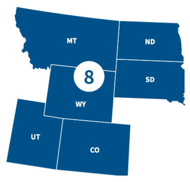
FEMA Region 8 office, located in Denver, CO, partners with federal emergency management for 29 Tribal Nations and the following states.

States

Visit the state's page for localized content, such as disaster recovery centers, flood maps, fact sheets, jobs and other resources.

Leadership

Graphic
Graphic that represents placeholder that is female

Acting Regional Administrator

Graphic
A stock figure of a man

Acting Deputy Regional Administrator

Region 8 Resources

Use the search filters below to browse content tailored to help Region 8 prepare for, respond to and recover from disasters.

FEMA ArtWorks Program

The FEMA ArtWorks program is designed to raise risk awareness and start dialogues on the need and value of flood mitigation. The program does this through partnerships between FEMA, artists, and local communities. The partners share the goal of communicating the importance of mitigation to reduce risk by using information people can relate to in a personal way.

Project: Floodline Chime Pavilion

Our second ArtWorks project, the Floodline Chime Pavilion is a mobile work by Nathan Hall and Drew Austin. It’s a steel structure that supports suspended, laser-etched aluminum chimes that map the floodplain levels in vulnerable neighborhoods in Denver, CO.  The length of the chimes and the deepness of their tones correspond to the flood level history and potential risk along the South Platte waterway.  Using handheld strikers made of wood collected from the floodplain, participants are encouraged to enter the pavilion and gently strike the chimes.” 

Project: Community Forms

The first project completed under the FEMA ArtWorks banner supported by Region 8, Community Forms is an art installation that serves as both a community gathering space and a means to redirect stormwater. Learn more about Community Forms.

Find Your Flood Map

Risk Mapping, Assessment and Planning (Risk MAP) is a national FEMA program that works with states, tribes, territories and local communities to evaluate and better understand their current flood risk, as well as the actions that can be taken to mitigate and become more resilient against future risk.

NFIP Flood Mapping Projects

FEMA works with communities throughout Region 8 to update and improve flood maps to provide the best flood risk information available. This allows communities and individuals to make informed decisions regarding where and how to build in a way that protects lives and property.

One of the final steps in the mapping process is a release of preliminary maps for all in the community to review. With this release, there is a 90-day appeal period, during which community members can appeal flood hazard information that they believe is in error.

Appeal packages must be submitted during the 90-day appeal period. Appeals must have supporting scientific or engineering data that show the information on the preliminary maps to be incorrect.

Visit FloodMaps for further details on the process. Preliminary mapping also may be viewed on FEMA’s Map Service Center.

alert - info

View 90-day appeal periods for Colorado, Montana, North Dakota, South Dakota, Utah and Wyoming.

Environmental Requirements to Apply for FEMA Funding

When a community applies for FEMA funding — such as Public Assistance, Hazard Mitigation Assistance or Preparedness Grants — potential impacts to the environment and cultural resources must be considered.

alert - info

NOTE: Environmental requirements do not apply to individuals and families applying for assistance.

Contact Us

General
303-235-4800

Flood Insurance
303-235-4988

News Desk
303-235-4908
fema-r8-newsdesk@fema.dhs.gov

Private Sector
303-235-4908
fema-r8-private-sector@fema.dhs.gov

Regional News and Information

Crow Tribe members who had damage caused by the August 6, 2024 severe storm and straight-line winds have until February 28, 2025 to apply for disaster assistance. They can apply at the Disaster Recovery Center located at the Black Lodge Community Center, I-90 at the Dunmore exit, #503
illustration of page of paper Press Release | Published:
After applying for assistance, you will get one or more letters explaining the status of your application. Your letter(s) may say ineligible or not approved, or even denied. Don’t be discouraged, FEMA may just need more information.
illustration of page of paper Fact Sheet | Published:
Event Date(s): -
Delta County’s flood insurance rate map update is nearing completion. The new maps will provide Delta County and Communities with more accurate flood risk information that can help local officials and residents make informed decisions about reducing flood risks and purchasing flood insurance.
illustration of a calendar FEMA Event | Published:
Rumors and misleading information spread after any disaster. Rumors about disaster assistance for the August 6, 2024 severe storm may keep Crow Tribe members from getting help with their damage. It is important to find trusted sources of information such as tribal officials and FEMA staff at the Disaster Recovery Center.
illustration of page of paper Fact Sheet | Published:
FEMA disaster assistance specialists will visit several Crow Tribe locations to help people apply for disaster assistance. Crow Tribe members who had damage to a home, rental home, trailer or mobile home, or had damage to property caused by the August 6, 2024 severe storm and straight-line winds can apply for help with repairs and other needs.
illustration of page of paper Press Release | Published:
Last updated